
![]()
Επιλέξτε γλώσσα / Sprache wählen / Select language


")


Monuments of Epirus
Katsanochoria
Geographical Description
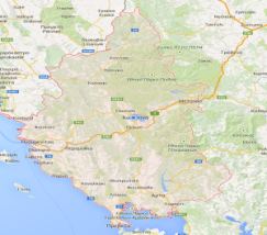
Katsanohoria is a group of eleven villages scattered over a small area in Ioannina Prefecture of Dodoni Province in Greece. They lie to the south-east of Ioannina, along the second provincial road leading from Ioannina to Pramanta. Administratively, the villages now belong to the municipality of Northern Tzoumerka (http://www.voreiatzoumerka.gr/ and http://www.dimosprofile.gr/media/dimos-vorion-tzoumerkon/). The wider region of Katsanohoria villages is delineated to the east by Arachthus Gorge, to the south by Mt. Xerovouni (1614 m.), to the west by the ground elevations of Aetorachi (1060 m.) and to the north by those of Tsouka http://www.mapgreece.gr/
The eleven villages constituting Katsanohoria, in alphabetical order, are the following: Aetorachi (former Kotortsi), Helleniko (former Lozetzi), Kalentzi, Koretiane, Kostitse, Lazena, Nestora, Patero, Pegadia (former Valtsiora), Plesia and Fortosi.
Archaeological finds, discovered around the small plain of Plesia and Kalentzi, suggest that the first residents settled in the area in the beginning of the 3rd c. BCE. They are comprised of the remains of an acropolis, lying to the east of Kalentzi, as well as of other finds, such as steles and sepulchral objects to the north-east of Plesia, in the area called “Kakolagado”. Coins of the Epirote League (ΚοινότωνΗπειρωτών) have been discovered in the Koretiane vicinity. The next available information on the region comes from the early 14th century and, in particular, from a Chrysobul dictated by Emperor Andronicus II, by which the estate property of the Metropolitan bishopric is confirmed along with further land concessions. From this period onwards, there is a ceaseless flow of information on the region, occasionally rich, streaming from private or public documents and archives or from inscriptions placed within the interior of temples of most of the villages.
Historical Information
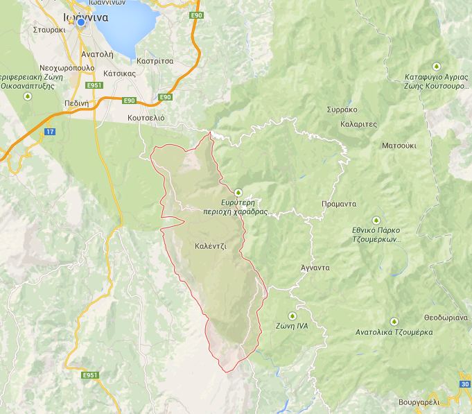
Plesia ( Πλέσσια ή Πλαίσια): Plesia is one of the eleven villages forming Katsanahoria and one of the two located in the small plain (the other being Kalentzi).
It lies on an attitude of 620 meters. The settlement is built amphitheatrically, orientated towards the village’s central square, which hosts most of the social, economic, cultural and religious activities of the village. The village is divided into two main neighborhoods (mahalades) by a dry dell stretching through the village’s center, near the main square.
The etymology of the village’s name was an issue of controversy, even among the residents of the village, who were unable to decide whether it was “Plésia” (feminine gender) or “Plèsia” (neutral gender, plural). Today the second variant has been etymologically substantiated and is widely accepted.
The main monuments worthy of visiting by tourists are the temples of St George, St Nicholas, St Demetrius, Holy Apostles, St Constantine, Dormition of the Mother of God (cathedral), Dormition of the Mother of God (Panagopoulou), Prophet Elias, the chapel of Zoödochos Pege (Life-giving Spring/Panagopoula) and of Metamorphosis of the Savior (Transfiguration of Jesus) and St John’s Monastery.

Greece
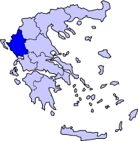
Epirus
Katsanochoria
Copyright © 2015 Monuments of Epirus
Department of History and Archaeology
Univsrsity of Ioannina
![]()
